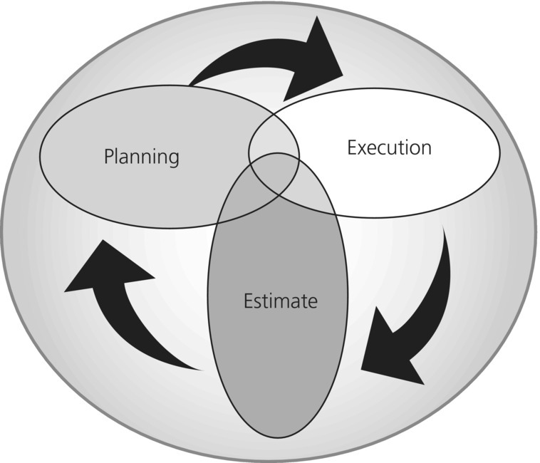
Chapter 33 Joanne McGovern and Sandy Bogucki In the United States, transportation of ill or injured patients is typically accomplished by local, ground-based EMS, sometimes supplemented by air medical services. Routine patient transports generally involve point-to-point transfer, from point of injury or onset of illness to medical treatment facility, or direct from one medical treatment facility to another. For incidents requiring simultaneous transport of multiple patients, mutual aid agreements and contingency contracts may be used to access EMS resources from beyond normal, jurisdictional boundaries. This chapter focuses on the planning and execution required for large-scale or catastrophic events, when transportation of hundreds or even thousands of patients is necessary. Patient evacuation under such circumstances differs substantially from routine EMS operations. For example, destination medical facilities may be great distances away to find either specialty care or hospitals unaffected by the incident. Transport of the patients often involves a sequence of multiple transportation modalities, including some that may not be medically configured. It is useful to consider three overlapping phases in a cycle of planning for mass patient movement (Figure 33.1) development of an estimate, using that information to generate a plan, and execution of the plan. Figure 33.1 Estimate, planning, and execution cycle. An estimate is developed to characterize specific threats, geographic and demographic information about an area, and populations that may require medical transport in order to identify requirements. The estimate includes potential casualty volumes, and is used to evaluate possible courses of action. Estimates for patient evacuation consider the nature of specific threats, with their inherent effects on patients and their ability to evacuate. The following categories are typically included. Threats can be analyzed by identifying the most likely and most dangerous hazards that may threaten a given community. Fires or bombs can generate mass casualty events when they involve high-density occupancies or mass gathering venues. In the case of states along the Gulf Coast, the most likely natural threats may be hurricanes, while earthquakes are a greater threat along the west coast and New Madrid faults. Of all threats, which are most likely to occur and what are the consequences? How often do these events happen? Are they predictable or do they occur without warning? In recent years, mass evacuation and patient movement planning efforts have focused on two types of scenarios: responders are aware that an incident is imminent (e.g. hurricanes or major flooding), and responders have no warning prior to the incident (e.g. earthquakes, detonation of an improvised nuclear device). In a “notice” event, there is some opportunity to conduct preincident evacuation of vulnerable populations, including those in medical facilities, make preparations to shelter them in place if appropriate, and to prestage assets that will be needed during and after the event. Like the decision to order evacuation of a political jurisdiction, the decision to evacuate medical institutions and custodial facilities before landfall is difficult and multifactorial. The decision maker(s) must weigh the risk of moving patients out of the stable hospital environment against the threats posed. In the case of a hurricane, analysis of the threat considers the strength and direction of the storm, the survivability and sustainability of the facility, whether the facility is located in a known storm surge or flood zone, availability of supplies, and staffing. The effects of a “no-notice” event tend to be immediate, causing instantaneous destruction, and may generate large numbers of casualties. Although notice and no-notice events share many similarities, the defining difference is preincident time to implement specific mitigation and response strategies. For discussion of patient evacuation, notice events can involve mass patient movement both preevent, where circumstances may be somewhat more controlled, and postevent. No-notice events may involve evacuation of large numbers of casualties as well as evacuation of damaged medical facilities postincident. One technique of evaluating the threat is looking at it from combined environmental, socioeconomic, and structural perspectives. For example, a hurricane can produce wind damage, storm surge flooding, debris, and water contamination. The types of injuries and effects on the population’s health can be predicted. High waters will generate drowning and exposure victims. Flying debris may produce blunt trauma injuries. In general, however, hurricanes do not typically generate the numbers of injuries that other threats might. As the storm affects local infrastructure, utilities will be lost and transportation networks will be damaged or disrupted. Health care facilities that are not primarily damaged or flooded may be placed at risk due to lack of utilities, supplies, and staff who cannot get to work. Public health issues are also relevant to patient evacuation. Medically fragile populations living at home may need to be evacuated to facilities that can manage their conditions rather than typical school- or church-based shelters. After landfall, people who have been displaced may not have access to their medications or funds, thus exacerbating illnesses that existed before the storm. The lack of potable water can contribute to cases of dehydration, water-borne illnesses, and diarrhea. All of these circumstances can increase requirements for medical evacuation associated with hurricanes. In an event such as an earthquake, the environmental factors are different. Given that earthquakes occur without warning, the population at risk may be significantly greater than in a hurricane, because there is little opportunity to seek shelter from structure collapse, falling debris, and in some cases fire. Infrastructure damage could be severe, depending on the magnitude and duration of the quake. Transportation networks may be disrupted due to collapse of bridges, buckling of roads, liquefaction of airfields, and breaks in rail lines. Medical facilities are at risk not only due to the lack of utilities, staff, and supply channels, but also direct structural damage or failure. Public health concerns are similar since in a disaster of this nature and magnitude, populations would be displaced, property would be lost, and access to basic needs such as food, water, and shelter would be difficult. After examining the threat and its possible effects, the next step is to examine the community itself. The vulnerability and characteristic consequences of each type of threat need to be systematically analyzed to determine what needs for mass patient movement or evacuation may be generated in a community or region. FEMA’s Community Planning Guide 201 (Threat and Hazard Identification and Risk Assessment) provides a useful format for performing such analysis [1]. In conducting the estimate, area characteristics need to be examined in relationship to the threat, the generation of casualties, and the effect on patients and medical evacuation. What is the terrain like? Where are the low-lying areas? What parts of the terrain are most likely to be affected by a storm surge or lowland flooding? Anything that places transportation networks or nodes underwater is going to hinder medical evacuation efforts. Areas prone to landslides are another hazard. In areas where the principal threat is from an earthquake, geology is key, including the location of fault lines, the types of soil and fill that exist in the area, and the location of bedrock, among other features. This information is critical because the amount of damage induced by an earthquake is somewhat predictable, and will be determined not only by the magnitude and location of the quake but also by the types of ground material under structures. Regional weather patterns are important since variances in temperatures and precipitation affect both emergency operations and human performance. High temperatures will contribute to patient dehydration and hyperthermia if patients cannot be sheltered from the environment. Weather can also affect evacuation operations, such as restricting flight operations or exacerbating flooding. How is the land being used? Is it urban or rural? What are the major industries in the area? Where are toxic industrial chemicals or materials likely to be used or stored? These are a few of the environmental factors that require attention as potential generators of casualties or hindrances to evacuation. An interesting environmental factor that altered the medical response by the People’s Republic of China to the 2010 Yushu earthquake was the altitude of the Tibetan plateau. Over 75% of the emergency responders developed acute mountain sickness in the first hours to days on-scene, and the decision had to be made to evacuate the hospital patients and victims by air to hospitals at lower elevations [2]. Population densities and the demographics of the area are another significant characteristic to examine. US Census Bureau databases can help provide a macro-level view of a community [3]. Additional considerations include locations of special populations such as the very old and the very young, since they are among the most fragile and may be more vulnerable to consequences of a disaster. The location of medical institutions, including hospitals, nursing homes, long-term care facilities, and hospices, must be identified along with their proximity to known hazard areas. These overlay maps can be conveniently generated using a variety of geographic information systems (GIS) products. If a facility is below the height of a predicted storm surge or located in a flood zone, then it may need to be evacuated before landfall, in the setting of a hurricane. The question here is whether a structure can withstand the threat at hand, whether it be the winds of a hurricane or the shaking of an earthquake. It is useful to document which facilities have been surveyed or rated by engineers for ability to withstand relevant hazards. Many structures may have been “hardened” following previous disasters or in response to engineering surveys. Although most routine patient transport occurs by ground ambulance, in a mass medical evacuation, all alternatives must be considered, as demand will exceed available, standard medical evacuation platforms. Further, ground transportation may be limited due to damage to networks and the convergence of responders trying to enter an area while victims are trying to leave. Transportation must be examined from several aspects. First is the identification of transportation nodes, which are the primary locations that serve as access points, intermediary points, and destinations along the transportation network [4]. In the case of medical evacuation, the primary nodes would be hospitals and other types of medical institutions. During a disaster, other points, such as casualty collection points and ambulance exchange points, would also serve as nodes. For larger operations, critical nodes may include airports, rail stations, landing zones, ferry berths, and other ports of embarkation and debarkation. Next, transportation networks need to be identified, including roads and highways, rails, airspace, waterways, and the infrastructure it takes to operate them. Postdisaster, determining which networks are intact and when the damaged ones may return to service is essential. In the event of a catastrophic disaster, all working transportation networks have to be evaluated as possible means for evacuation. Volume and demand will dictate that all viable means are used to move casualties and patients to safety. After identifying the nodes and the networks, planners have to predict how a given disaster such as a hurricane or an earthquake will affect transportation systems and consider ways to either mitigate or work around the likely disruptions. Finally, the demands that will be placed on the system have to be examined and the approach must be holistic. Responders, rescue workers, and various organizations and supplies will likely be coming into the affected area as victims are trying to evacuate the area. Who has priority? What networks will be used, and by whom? What demands will be placed on the system by medical evacuation? These questions have to be addressed in the estimate and in plans at all levels (local, state, and federal) in order for the system to work, but the analysis must begin in the local community. Prior to a disaster, patients are already present in various elements of the medical system. Many more are dependent on regular, frequent access to outpatient services, including dialysis, primary care, specialty clinics, narcotics programs, pharmacy, and others. There is also a homecare/medically fragile part of any community’s population, with a substantial proportion being technology dependent and/or mobility impaired. The challenge regarding this particular group is to prospectively identify individuals as well as their residences. Typically the majority are elders living with family members. A catastrophic incident itself will generate casualties that must also be absorbed by the medical system. This rate will vary depending on the type of incident, its magnitude, the time of day, and the population density where it occurs. Medical evacuation requirements generated by a disaster will be determined by the following variables.
Mass casualty evacuation and patient movement
Introduction
Developing an estimate
Threat
Notice versus no-notice events
Threat assessment
Characteristics of the area
Terrain
Weather
Environmental factors
Population density and demographics
Location of medical institutions
Structural integrity of medical institutions
Regional transportation
Estimating requirements for medical evacuation
Related posts:


Stay updated, free articles. Join our Telegram channel

Full access? Get Clinical Tree